 |
| Map of Alaska - The Alaska Peninsula Region is boxed.1 |
 | ||||
| Map of the Alaska Peninsula Region - The APMT is the yellow region.2 |
Regional Characteristics
Located on the southern portion of the Alaskan Peninsula, the APMT covers the region from the mouth of Cook Inlet on the east-most portion of the peninsula to the west-most tip of the peninsula. The APMT also includes Unimak Island, off the peninsula’s tip, and a large portion of the Kodiak Island archipelago. This region is characterized primarily by various dwarf scrub communities including dwarf, low, and tall scrubs. Scrub communities primarily consist of various species of dwarf shrubs, like crowberry, and willow. Due to its proximity to the ocean, the APMT has less extreme temperature fluctuations and higher precipitation than the average boreal forest. Furthermore, unlike most boreal forests, the APMT does not suffer from permafrost, as a result of its more moderate maritime climate. While the lack of permafrost is good for vegetation, this region’s soil is composed of volcanic ash and cinders, making it difficult for vegetation to flourish. Amidst the numerous mountain ridges of this region are volcanoes that range from 1600 to 2400 meters high.
.bmp) |
| A Mountain Range in the Alaska Peninsula National Wildlife Refuge3 |
The History of the APMT
Native Alaskans have been the primary inhabitants of the APMT for most of its history. However, during the 18th and 19th century, two European-generated booms in certain commodities played a large role in the development of APMT’s local economies and environments. The first major boom was The Russian Fur Boom, which occurred when Russians arrived on the Aleutian Islands in the mid eighteenth century and sought the valuable fur of seals and sea otters. After moving from Kodiak island through the Alaska Peninsula, the Russians established the Russian American company and constructed settlements along the APMT'S coastline. Ultimately, this boom’s environmental impact consisted of a severe decrease in the sea otter and seal population and the habitat dislocation caused by coastal Russian settlements. The second boom that affected the APMT was the Salmon boom, which led to the establishment of a salmon cannery on Kodiak Island in 1882. Due to a lack of government regulations, commercial overfishing became an issue and natives had less salmon to live off of. Consequently, native settlements that couldn’t subsist off of salmon were often replaced by salmon canneries. This marked an environmentally unfriendly shift from subsistence fishing to commercial fishing, although subsistence fishing among natives in the APMT is still prevalent today.
.png "Sand Point") |
| Sand Point, Alaska4 |
The current environmental state of the APMT has not
altered much from its historical state due to the paucity of human settlement in
the region. What little settlement there has been in the APMT has largely
resided near the coast, where small fisheries and ports have supported local
economies. Sand Point is one of the only sizable cities in the APMT today, and it was "founded in 1898 by a San
Francisco fishing company as a trading post and cod-fishing station.”5 During
the early 1900’s Sand Point became a center for selling and repairing gold
mining machinery. In the 1930’s, gold-mining took a back-seat to fishing, which
has been the pillar of Sand Point economy every since. The rest of the APMT has
similarly relied on commercial and subsistence fishing during the 20th
century, with minor attempts at mining and coal/petroleum extraction. Thus, the APMT’s environment has been
well preserved and protected for the past century, because of the negligible environmental impact of fishing and the lack of habitat dislocation brought on by significant population growth.
 |
| Apollo Mine on Unga Island circa 1891-19226 |
Another reason for the pristine condition of the
APMT is the lack of significant industrial
intervention in the region, during the 20th century. One reason for this lack of interest is, as
geologist Bryan Sralla says, the fact that the Alaskan Peninsula “is largely
devoid of significant reservoir targets,”7 for oil. In the first half of the 20th
century the possibility of oil led many oil companies to the Alaskan Peninsula,
with regional interest reaching a peak in the 1940’s and 1950’s. However, after
companies came upon a few dry wells, optimism about regional oil exploration
flamed out, and it has been dead for quite some time. Regarding the APMT's mining history, the Apollo mine on Unga Island was an economically viable gold mine that
produced 150 ounces of gold from 1891 to 1922, but it has been abandoned for
quite some time.Consequently, the APMT
did not suffered much from the debilitating impact of oil extraction and mining during the 20th century.
Current Human Impact on the APMT
 |
| An aerial shot of the Katmai National Park8 |
The APMT is
home to seven protected areas including four wildlife refuges, one national
monument, one game sanctuary and one national park. In the entire Alaska
Peninsula, 69% of the lands are owned by the federal government and 18% of the
lands are owned by the state of Alaska. Of these federally managed areas, the
Katmai National Park (KNP) is notable for protecting a large brown bear
population and preserving the waterways that feed the Bristol Bay red salmon
fishery. While the KNP has a largely positive environmental impact, it still
allows for the sport hunting of brown bears. Concerns about brown bear
over-hunting emerged when the NPS increased the number of brown bear harvests,
and there was a decrease in observable bears. In a 2011 newsletter the NPS
pledged to reduce the number of annual hunts in the KNP from 28 to 21,
but the NPS has not released any data verifying whether brown bear hunting has
decreased. Despite the continued brown bear hunting, Katmai National Park is one of the many public conservation areas in the APMT that allows the region's flora and flauna to flourish. As the figures below demonstrate, the percentage of protected land in the APMT has increased from 1999 to 2006.
Conservation Status of regions in the APMT in 19999
Section Name
|
Alaska Peninsula
|
West Kodiak Island
|
Protected Status -
Status 1 & 2 (% of ecoregion)
|
44.40%
|
0%
|
Moderately Protected -
Status 3 (% of ecoregion)
|
12.90%
|
43.40%
|
Unprotected - Status 4
(% of ecoregion)
|
42.70%
|
56.60%
|
Total Area (km^2)
|
37,315
|
8,790
|
"Status
1 is represented by an area with an active management plan in operation to
maintain a natural state, within which natural disturbance events are allowed
to proceed without interference or are mimicked through management.
Status
2 is represented by an area generally managed for natural values but which may
receive use that degrades the quality of existing natural communities.
Status
3 is represented by public lands not designated for protection or management of
natural values. Legal mandates prevent the permanent conversion of natural
habitat types to anthropogenic habitat types and confer protection to federally
listed endangered and threatened species.
Status
4 is represented by private or public lands without an existing easement or
management agreement to maintain native species and natural communities and
which are managed for intensive human use."9
Conservation Status of regions in the APMT in 2006 10
Ecoregion
|
Alaska Peninsula
|
Kodiak Island
|
Total Area (Acres)
|
25,533,884
|
3,144,935
|
CMS 1 and 2 (% of ecoregion)
|
70.70%
|
63.80%
|
CMS 3 (% of ecoregion)
|
0.10%
|
0.00%
|
CMS 4 (% of ecoregion)
|
18.10%
|
10.90%
|
Native-Owned Lands (% of ecoregion)
|
11.20%
|
25.30%
|
CMS 1 & 2 and
Native-Owned Lands (% of ecoregion)
|
81.80%
|
89.10%
|
Increase With
Native-Owned Lands (% of ecoregion)
|
15.80%
|
39.70%
|
"CMS 1 = A management plan permanently protects the total land system, allowing natural disturbance events; motorized access is limited.
CMS 2 = A management plan protects the total land system but
some/all natural disturbance events are suppressed and human use occurs on more
than 5% of land
CMS 3 = Management includes protection of select ecological
features; intensive anthropogenic use (e.g. resource extraction, military
exercises, developed/motorized recreation) occurs on more than 5% of the land.
CMS 4 Public = Publicly owned, but not subject to a management plan
or regulation that includes protection of ecological features.
CMS 4 Private = Privately owned and either management intent is
unknown or management intent doesn't protect for ecological features."10
 |
"Eskimo man tends his racks of drying salmon" - An example of subsistence11 |
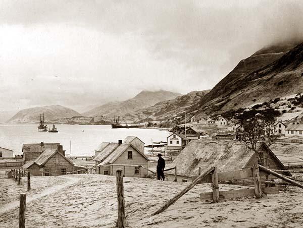 | |||
| "Kodiak sometime shortly after 1900"12 |
 |
| Kodiak Today13 |
As mentioned earlier, native
peoples of the APMT still subsist of the resources that the ecosystem provides
them with. According to a 2004 Nature Conservancy report, “In comparison to
state per capita averages, southwest Alaska residents harvest 2.5 times as much
wild food (SWAMC 2003).” While native subsistence is prevalent in the APMT, competitive and commercial fishing play a big role in the economy of cities like Kodiak. These fishing practices dwindle the
salmon population, reducing the food supply for both predators and subsisting natives. Putting
commercial fishing aside, sport fishing accounts for over one third of jobs in
the Alaska Peninsula and is unlikely to comprise a growing portion of the local
economy as time goes on.
Future Human Impact on the APMT
 |
| Map of Alaska Peninsula with regions of potential gas and oil labeled14 |
Another potential
increase in future human impact may result from increased mining in the APMT.
Recently, companies such as Full Metal Minerals and Redstar
Gold Corp have shown interest in the APMT’s mining potential, with Redstar
returning to old sites like the Apollo Mine. This flux of mining activity is
having a negative impact on the environment, because mining leaves land
vulnerable to erosion, causing land and water pollution. Mining can also lead
to acid mine drainage, which occurs when the harmful dissolved metals seep into
rivers and lakes. The degree of mining in the APMT relatively low, but if
mining companies decide to amp up their efforts in the region, the environment will suffer. Thus, the future of the APMT's environmental status will primarily be determined by whether mining and oil devlopment will drastically increase. Other ecologically harmful activities like sport fishing and hunting will may increase incrementally over-time, but metal and oil commodities are more likely to experience the sudden booms that lead to environmental degradation.
Actions that Conservationists Can Take to Preserve the APMT
Despite the low level of current human impact in the
APMT, conservationists can still push for preventive measures to stave off a
decline in the region’s natural health.
One step to maintaining the environment would be for Alaska to limit the
amount of land it offers to mining and oil companies and ensure that the
resource extraction processes are relatively eco-friendly. While there aren’t
many mining or oil companies vying for land currently, the state government
still needs to ensure that the ecosystem will not suffer too severely if
there is a boom in mining/oil interest. Conservationists must put pressure on
the NPS to confirm that the Katmai National Park decreases the amount of brown
bear hunts it allows for annually. Sport fishing also has a negative impact on
the ecosystem, and legislation to regulate that activity would be a step in the
right direction. These efforts to limit environmentally destructive activities
will help to maintain the natural order of the APMT ecosystem.
 |
Brown Bears in the Katmai National Park15
|
In addition to preventative measures,
conservationists must also look towards developing and expanding conservation
areas. A book called Terrestrial
Ecosystems of North America recommended that the Kodiak National Wildlife Refuge use
Exxon Valdez settlement funds to expand the refuge in 1999. Similar actions can
be employed to increase the amount of land managed by the government, rather
than private companies. Conservationists must carefully select what
habitats/species of animals to target so that they can decide whether to
develop federally managed land or purchase new land for conservation. Along with protecting terrestrial species, conservationists must also protect aquatic animals by employing ecologically sustainable water
management and securing instream flow reservations. These two actions
will help to preserve aquatic life and the animals who feed off of it. Lastly, if future and current infrastructure
and resource extraction projects are harmful to these targeted, at-risk
habitats, conservationists must intervene to prevent damaging industrial activities. All of these conservation efforts will go a long way in helping to preserve the natural splendor of the APMT.
Reference List
5. "Sand
Point." Alaska Community Database Community Information Summaries.
Web.
<http://www.commerce.state.ak.us/dca/commd/CIS.cfm?Comm_Boro_name=Sand%20Point>.
7. Bailey,
Alan. "Alaska Peninsula worth Another Look." Petroleum News.
14 Oct. 2007.
Web.
<http://www.petroleumnews.com/pntruncate/194482742.shtml>.
9. Duffy, David C., Keith Boggs, Randall H. Hagenstein, Robert
Lipkin, and Julie A. Michaelson.
"Landscape Assessment of the Degree of
Protection of Alaska's Terrestrial Biodiversity." Conservation Biology
13.6 (1999):
1332-1343. Wiley Online Library. 24 Dec. 2011. Web.
http://onlinelibrary.wiley.com/doi/10.1046/j.1523-1739.1999.98063.x/full
10. Smith, Corinne, Shane Feirer, Randy Hagenstein, Amalie Couvillion, and Sarah Leonard.
“Alaska Peninsula and Bristol Bay Basin ECOREGIONAL ASSESSMENT." The Nature Conservancy. Dec.2003.
http://onlinelibrary.wiley.com/doi/10.1046/j.1523-1739.1999.98063.x/full
10. Smith, Corinne, Shane Feirer, Randy Hagenstein, Amalie Couvillion, and Sarah Leonard.
"Assessing
Protection of Alaska's Biodiversity." The Nature Conservancy. June 2006. Web.
<http://www.nature.org/ourinitiatives/regions/northamerica/unitedstates/alaska/placesweprotect/alaska-conservation-blueprint.pdf>
“Alaska Peninsula and Bristol Bay Basin ECOREGIONAL ASSESSMENT." The Nature Conservancy. Dec.2003.
<http://east.tnc.org/eastfile/72/Alaska_Peninsula_and_Bristol_Bay_Basin_Ecoregional_Assessment.pdf>
Berg,
Linda R., Mary Catherine. Hager, and Hassenzhal M. David. Visualizing
EnvironmentalScience.
3rded. Hoboken, NJ: Wiley in Collaboration with the National
Geographic Society, 2011.
Lidji, Erik. "Hewitt Drops N. Aleutian Leases; Armstrong Adds North Slope Acres." Petroleum
News.
14 Nov. 2010. Web.
<http://www.petroleumnews.com/pntruncate/311186021.shtml>
Pearson,
Roger W., Edwin W. Rhoades, and Carol E. Lewis. "Alaska Multibooms." University
of
Alaska Fairbanks. N.p., Jan. 1990. Web. <http://www.uaf.edu/files/snras/C73.pdf>
Alaska Fairbanks. N.p., Jan. 1990. Web. <http://www.uaf.edu/files/snras/C73.pdf>
"Katmai
Guided Hunting Concession." National Parks Conservation Association.
2012. Web.
<http://www.npca.org/protecting-our-parks/wildlife-habitat/katmai-guided-hunting.html>.
Lasley,
Shane. "Mining News: Explorers Return to Alaska Peninsula." Petroleum
News. 20
Nov. 2011. Web.
<http://www.petroleumnews.com/pntruncate/403493638.shtml>.
"Our
Mission." Nushagak-Mulchatna Wood-Tikchik Land Trust. Web.
<http://www.nmwtlandtrust.org/who/mission.php>.
Ricketts,
Taylor H. Terrestrial Ecoregions of North America: A Conservation Assessment.
Washington,D.C.: Island, 1999.
Washington,D.C.: Island, 1999.
.
Pictures
1. Map
of Alaska Retrieved from the Greenwich Mean
Time Website:
http://wwp.greenwichmeantime.com/time-zone/usa/alaska/time-alaska/
2. Wild Finder - Alaska Peninsula. Retrieved from the World Wild Finder Website:
http://worldwildlife.org/science/wildfinder/
3. Mountain Range, Alaska Peninsula National Wildlife Refuge. (21 May 2004). Originally From the U.S. Fish
and Wild Life National Digital Library Website:
http://en.wikipedia.org/wiki/File:Mountain_Range_Alaska_Peninsula_NWR.jpg#filehistory
4. Sand Point, AK: A View From Sand Point Cemetary Hill. (1 May 2006). Retrieved from the City Data Website:
http://www.city-data.com/picfilesc/picc14158.php
6. Apollo Mine on Unga Island. (29 March 2011). Retrieved from the NWSCA and Fishing Photos Website:
http://www.nwsalmoncanners.org/photo/?level=picture&id=50
8. Aerial of the road heading towards the volcanic landscape of the Valley of Ten Thousand Smokes in
Katmai National Park, Alaska. Retrieved from the Alaska-in-Pictures Website:
http://www.alaska-in-pictures.com/katmai-national-park-aerial-valley-of-ten-thousand-smokes-road-6310-pictures.htm
11. Eskimo man tends his racks of drying salmon. Originally from the Alaska-in-Pictures Website
http://northwesttribes.wordpress.com/foodways/eskimo-man-tends-his-racks-of-drying-salmon-2/
12. Kodiak, Alaska 1900s. (17 September 2009). Originally from the Wikipedia Website:
http://en.wikipedia.org/wiki/File:Kodiak,_Alaska_1900s.jpg#filehistory
13. Retrieved from the Kodiak (Alaska's Emerald City) Website: http://www.kodiak.org/business.html
14. Map showing Bristol Bay region and Alaska Peninsula... From The National Energy Technology Lab Website:
http://www.netl.doe.gov/index.html
15. Grizzly bears (Ursus arctos horribilis), Katmai National Park, Alaska, USA. (13 December, 2010) Retrieved
From the Flickr Website (picture for World Wild Finder):
http://www.flickr.com/photos/56601430@N05/5257995300/